 |
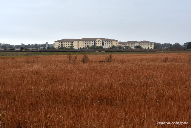
| The field of Imperata cylindrica at ground level (February 2022) |
Last year, I found that one can
track and view the progress of vegetation over time using Google Street View. This time, I used satellite imagery from Google Earth Pro (Desktop) to examine the expansion of clusters of
Imperata cylindrica (cogon grass) as they spread across an open field over almost a decade.
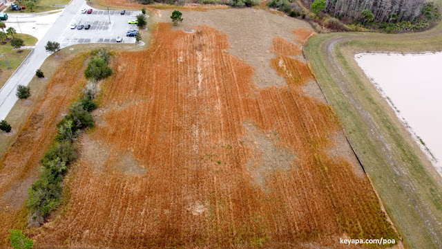 |
| Drone pic of red-hued Imperata cylindrica (cogon grass) clusters from height of 100 m (February 2022) |
I used historical satellite imagery from Google Earth Desktop to visualize the progress of the invasion from 2012 to 2021, then made an animated gif (see below) to show clearly how the initial small clusters spread and fused to form contiguous areas of infestation.
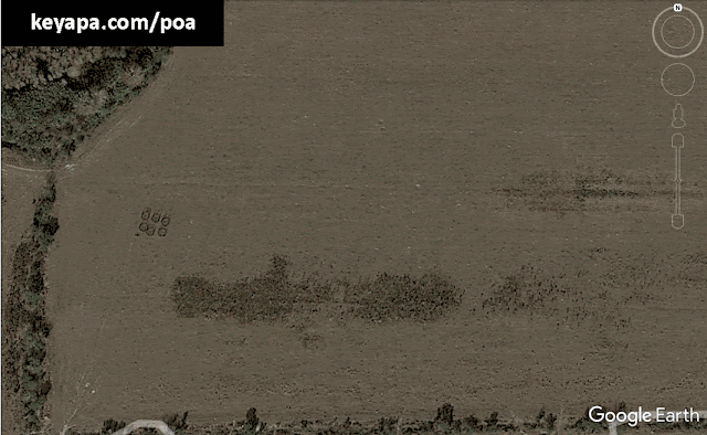 |
| Animated GIF showing expansion of I. cylindrica from 2012-2021 |
As can be seen from the animated gif above, a large cluster slowly expands while multiple smaller clusters develop and grow over the years. Each of the small infestations grows in a circular pattern, which is common during the spread of this rhizomatous species. In 9 years, the area of the field in view that is covered with cogon grass increases to at least five times what it was in 2012, pushing towards 8000 sqm in size - an area equivalent to almost 2 American football fields!
The gathering of such data shows that the use of online tools like Google Earth and Google Street View holds promise as an informal way of amassing historical data. This is because they allow anyone to derive useful information in an easy and efficient manner. Hopefully, more people learn how to use such tools to advance our knowledge about the world around us.
No comments:
Post a Comment